Beta data products
Download
Analysis of bathymetric data in all tidal flats in the TrilaWatt project area
The trilateral Wadden Sea, UNESCO World Heritage Site, is a channel-shoal environment with numerous stressors such astides, waves, or sea level rise. Planning and sustainable decision-making within this highly dynamic environment requiresrobust well-understood knowledge of these stressors. Descriptive long-term data of the entire trilateral Wadden Sea area,however, is not yet available.
We provide public (FAIR), consistent, high-resolution data for efficient decision making for the period of 2000 to 2020. For each tidal flat, mean tidal flat height growth and mean tidal flat area growth were analyzed for the long- and short-term periods (30 and 10 years, respectively).
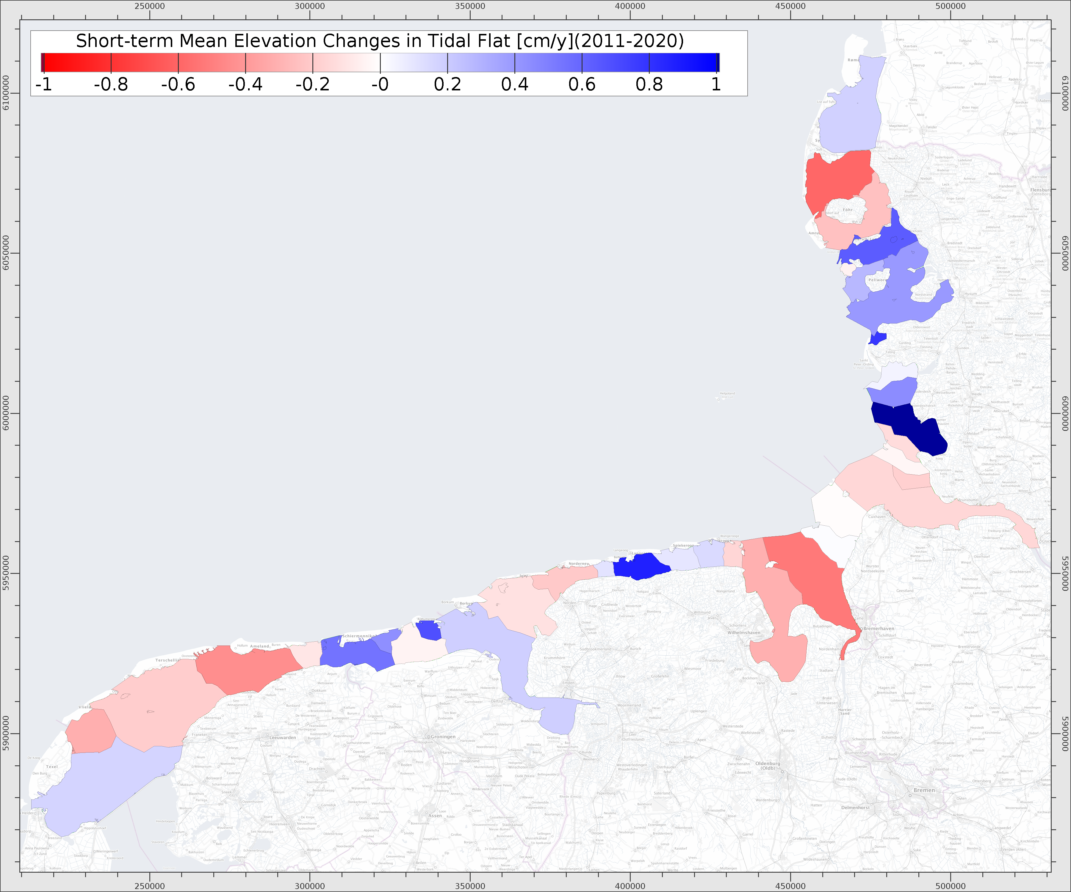
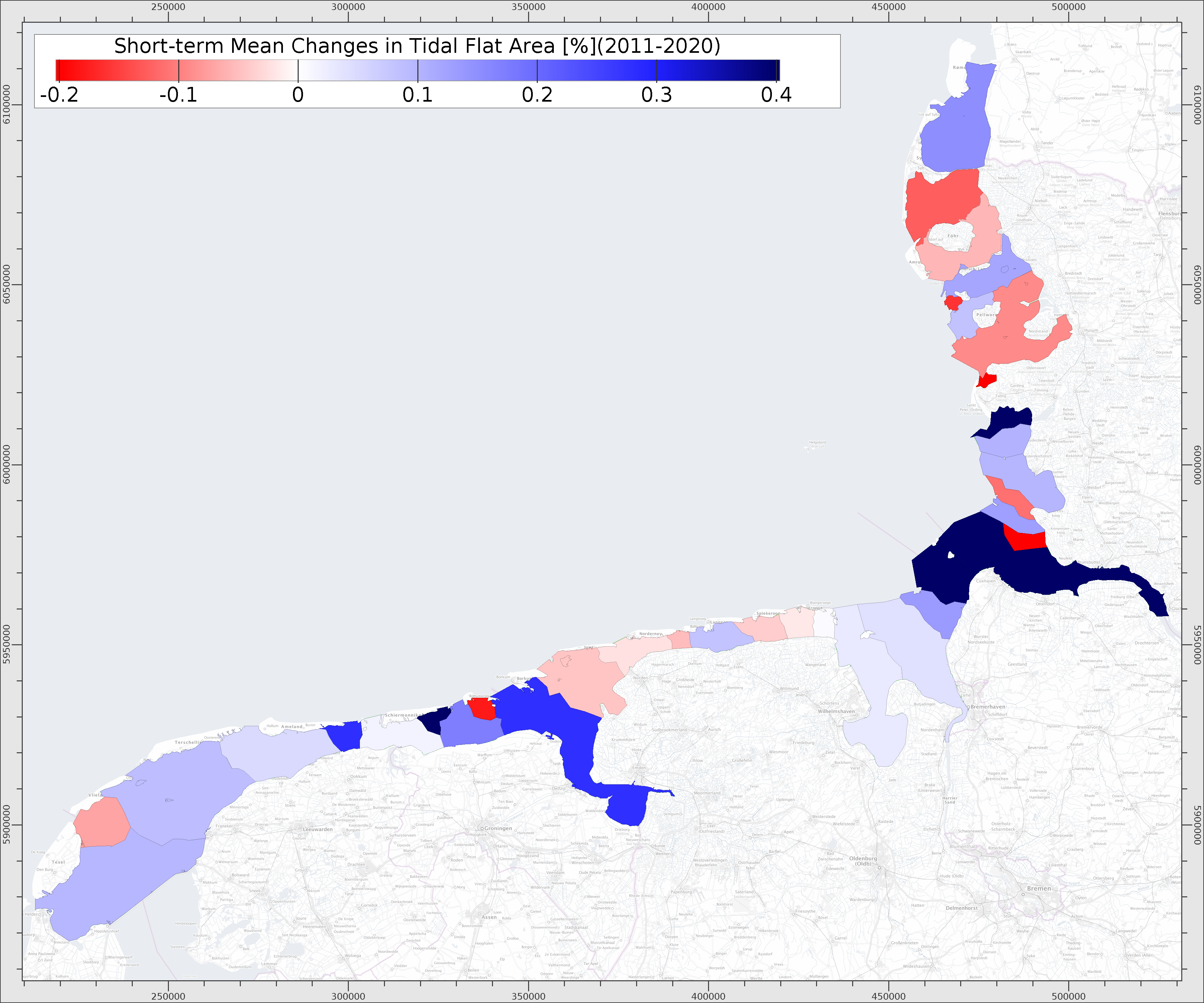
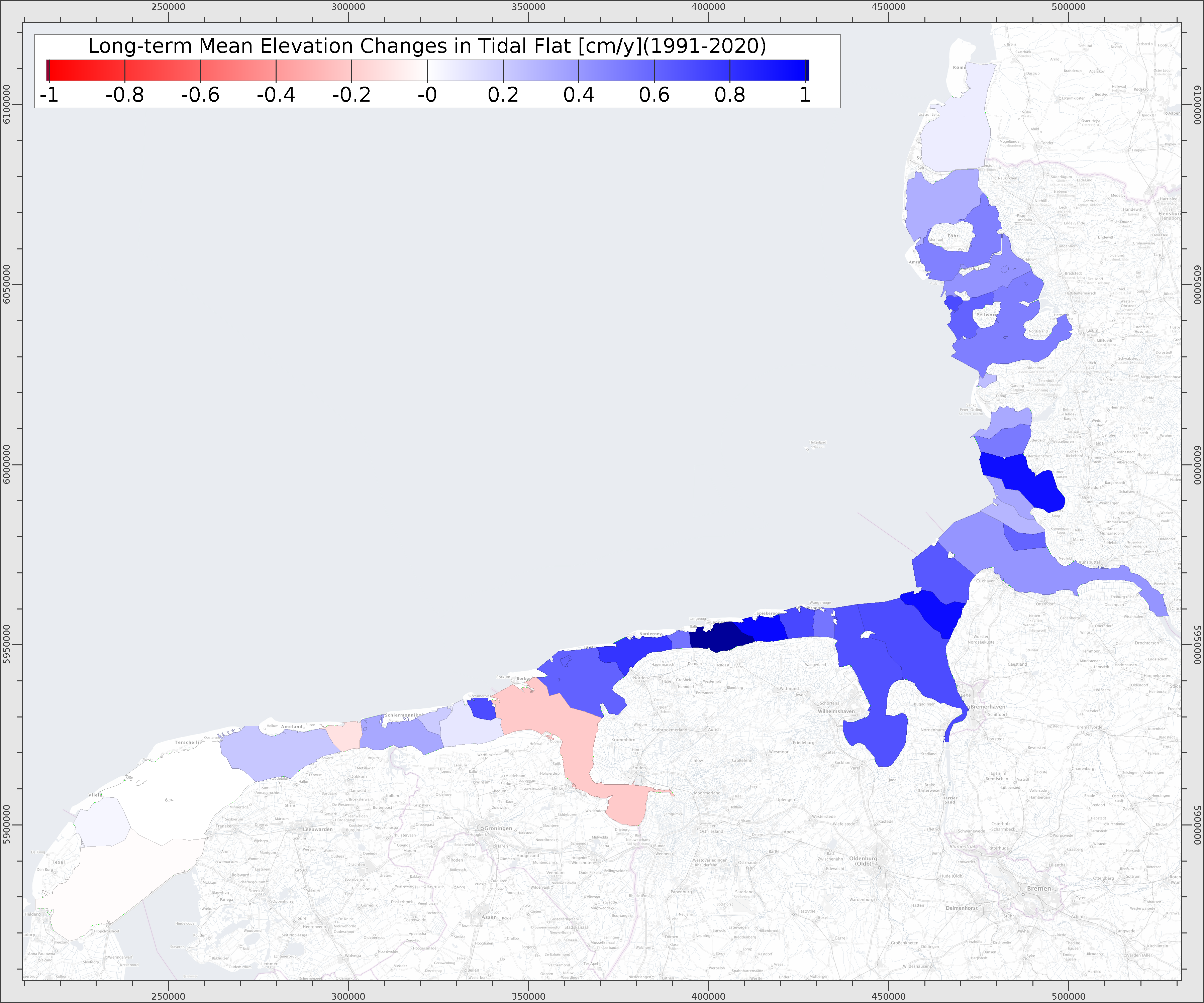
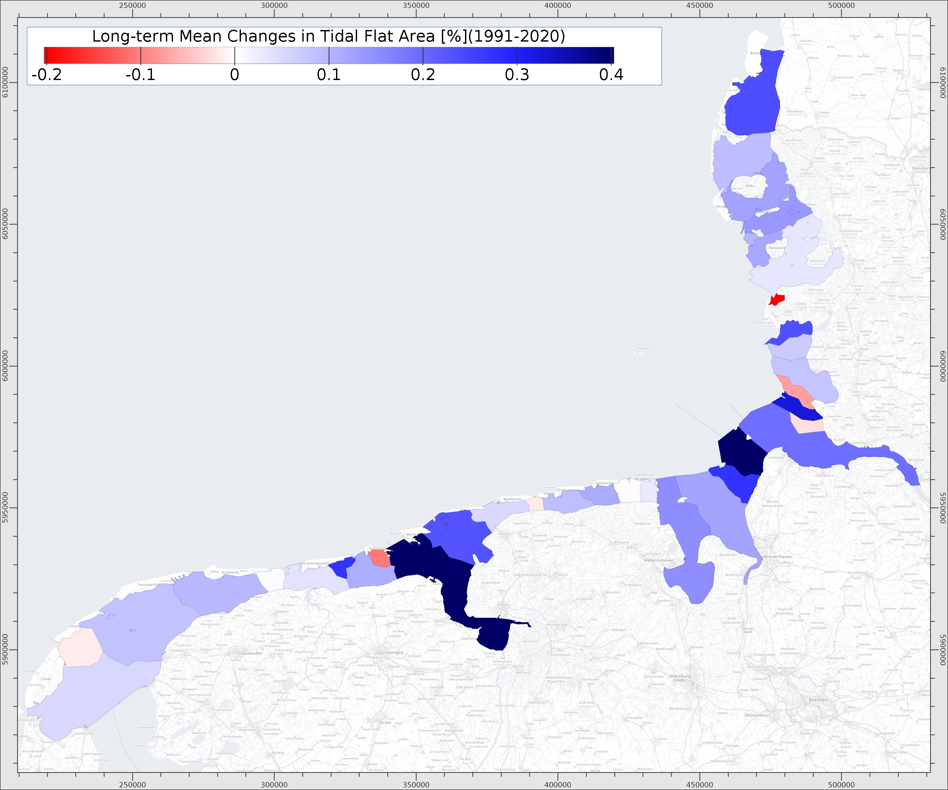
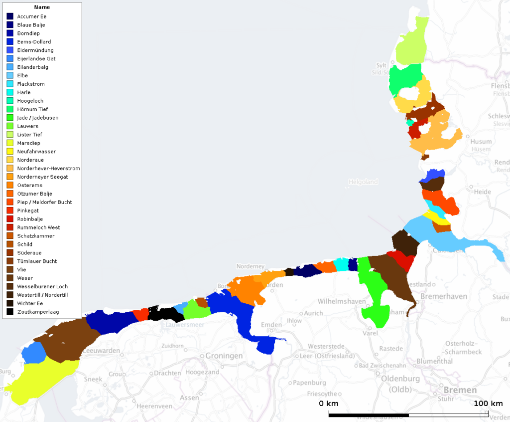
The results are presented in a poster and the data can also be downloaded as a GIS dataset in shapefile format (in different coordinate systems):
Social Contact