Use cases
The following scenarios represent applications of TrilaWatt Data products in different contexts.
All analyses derived from numerical modeling of the entire Trilateral Wadden Sea are available free of charge.
The corresponding data products are delivered with standardized metadata and can be downloaded via the Data viewer.
| 1. Sediment management |
|---|
The estimation of reference regional SPM concentrations and of sediment transport pathways is a crucial information in marine spatial planning. TrilaWatt collaborated with the German “Bundesanstalt für Gewässerkunde” to develop suiting data products for this purpose.
| 2. Cable route planning |
|---|
Cable routing for offshore wind-farms requires detailed knowledge about bathymetry and morphodynamics near the coast, as strong erosion may expose this critical infrastructure to the elements. We have developed a web-based WPS functionality with feedback from the North Sea Energy program to estimate the deepest bathymetric value from our data along a user-defined transect to assist with in this critical task.
| 3. The parameter intersector |
|---|
Biological habitats depend on several properties such as inundation, salinity, current velocity, shear stress, or turbity. To aid in identifying habitats, or other areas of interest with specific properties, a parameter intersector was developed as a web-based WPS functionality. This feature generates parameter intersections on-the-fly and enables a download option for the result.
| 4. MSRL reports |
|---|
The TrilaWatt consortium collaborated with a working group of the German administration to assist in German and European reporting duties with data contributions.
| 5. Tidal characteristic values – West Frisia |
|---|
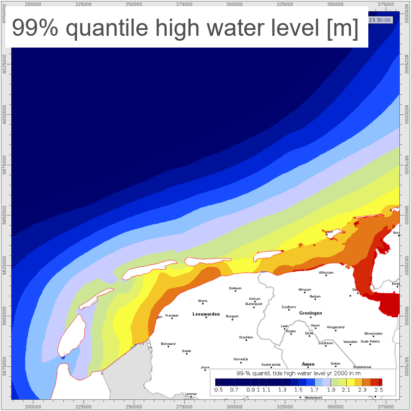
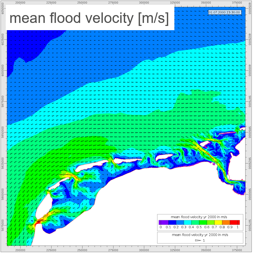
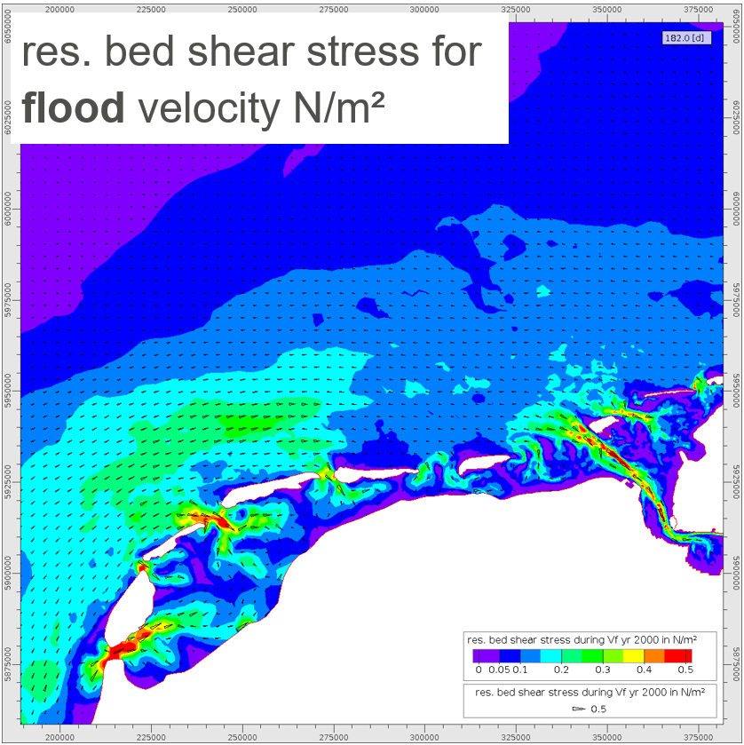
Tidal parameters (e.g. tidal range) are needed for marine spatial planning, coastal and offshore construction projects, ecological tasks, etc.
TrilaWatt can support these tasks with numerical simulation results from the entire trilateral Wadden Sea area.
Example results, as shown below, are:
- Tidal range
- Peak sea surface elevation
- Mean, peak, and residual flood and ebb current velocity, and bed shear stress
The tidal characteristics will be calculated for the years 2005, 2010, 2015, and 2020 and will be available for download in the common grid formats.
Please click image to enlarge it in slideshow mode.
| 6. Marine Renewable Energy |
|---|
Accelerating maritime spatial planning is imperative to ensure energy stability and rapid decarbonization.
Marine spatial planning requires high-resolution, up-to-date data from in situ observations or numerical models as access to ports, transportation routes, energy storage options, and their interactions with the marine environment must be assessed.
- Annual, high-resolution bathymetry data and surface sediment distribution until the year 2020 for a first assessment of a potential site.
- On-the-fly morphological analyses such as bathymetry differences to estimate morphological activity.
- Analyses of flow velocity above or below a threshold e.g., for tidal energy plants.
- Assessing tidal properties such as tidal range near a construction site.
- Extensive wave parameters to plan facility or constructional anchorage.
- Auxiliary information like distance between the mainland / islands.
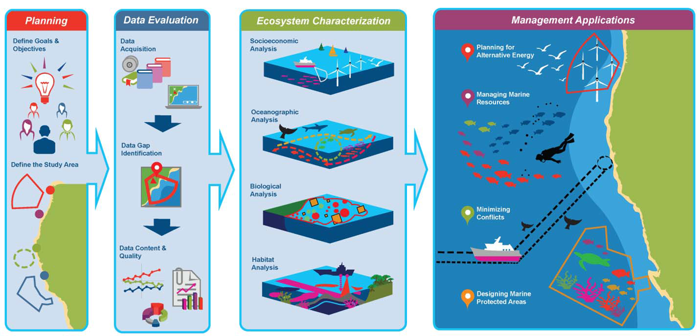
The ultimate goal of TrilaWatt is an interactive user interface for comprehensive data on hydrodynamics, bathymetry and surface sediments in the entire trilateral Wadden Sea. The envisioned interactive web viewer will facilitate the planning processes illustrated below (with compliments to O’Hagan, 2020, https://doi.org/10.2172/1633204).

An Example of a decision support process for marine spatial planning. TrilaWatt can assist with data evaluation and provide essential data for ecosystem characterization to ensure such management application (figure adapted from O’Hagan, 2020).


Social Contact